Friday, August 31, 2012

Black and Blue Lakes

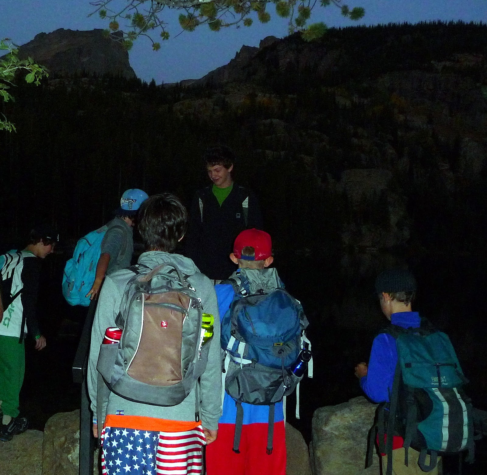
 Today was a hikemaster holiday. All of our hikes were cancelled, so Sarah, Clyde and I set out for Upper Glacier Gorge and Black and Blue Lakes. After we reached Mills Lake, we hiked further up the gorge through the mile or so of downed trees. The power of the wind that hit the area last November is hard to imagine. Above Shelf Creek, the landscape returns to normal, as if nothing had happened. Black Lake was waiting for us with a crystal blue sky overhead and wonderful reflections of McHenry's and Arrowhead. 

 Following Glacier Creek up the gorge, we struck off the trail when it started heading to the south. We stayed north and east, climbing several rocky benches, until we topped out at Blue Lake, located on its own enormous bench with a view of the immensity of upper Glacier Gorge. Spearhead rises to the south, encircled by the high peaks of Longs, Pagoda, Chiefshead, and McHenry's. 

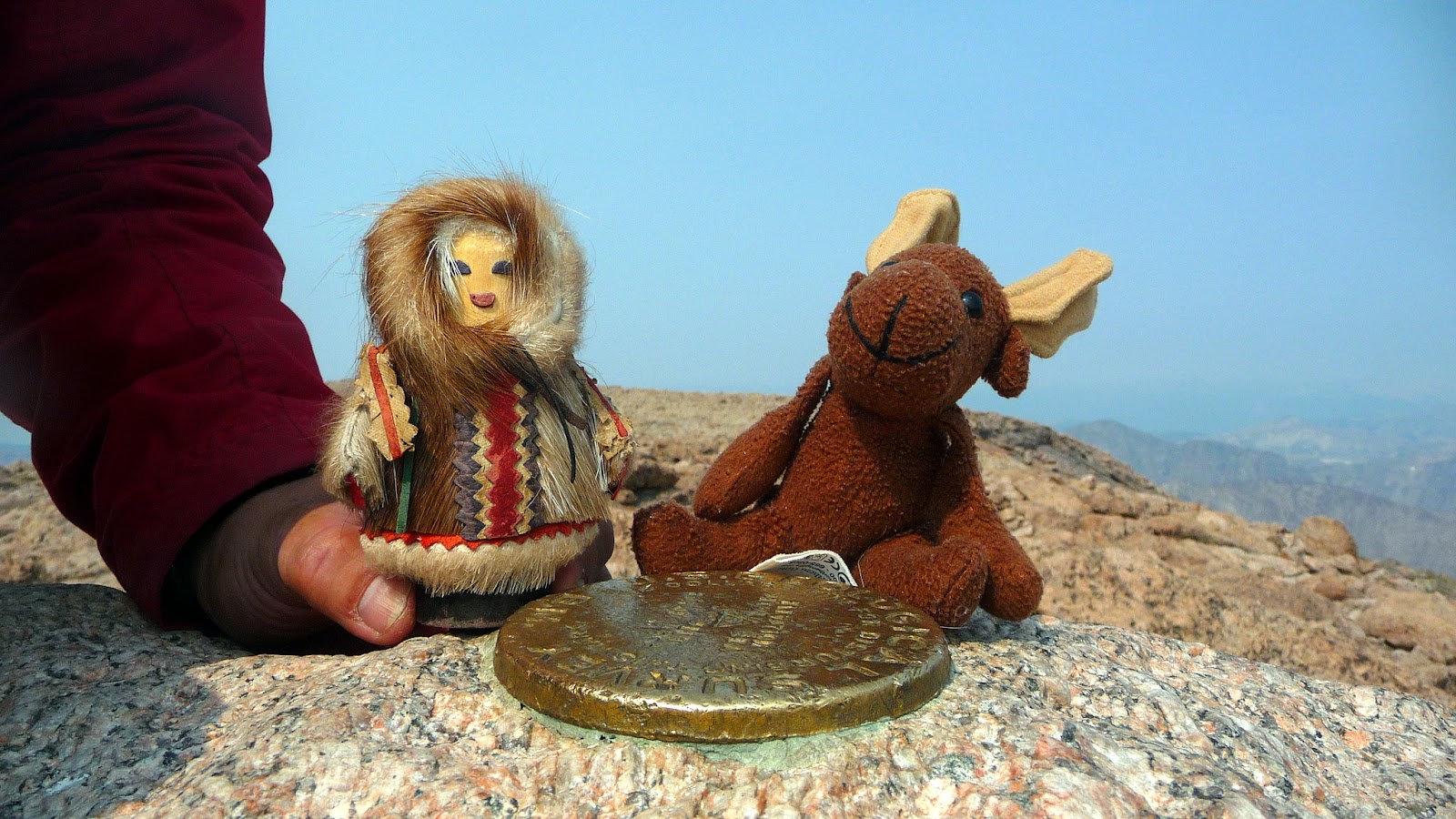
 Muneca was joined on this hike by her friend Jack Strong. She had been wondering what he had been up to all summer.

 Sarah, Maggie, Clyde, Muneca and Jack Strong at Blue Lake. 

 Just above Black Lake, water seems to seep from the granite into little waterfalls. The granite walls are so smooth here, it would be a perfect slide if it weren't vertical.

As we headed back down the fire trail, we could see signs that the summer is nearing an end. Patches of aspen are beginning to turn gold. Where has August gone?

Thursday, August 30, 2012

Isabelle Glacier

 Another early morning hike from Brainard Lake. Several large bull moose have been hanging out in the area this summer. Would we be lucky enough to spot one? Roy kept an eagle eye as we headed on the trail to the south of Long Lake. Not too far down the lake, he spotted Mr Moose enjoying his breakfast. After a quick glance our way, he resumed his meal. 

 Further up the trail we arrived at Isabelle Lake. Although the water in the lake is being drained to the thirsty plains as it is at the end of every summer, there is still plenty in the lake. There wasn't  a breath of air to disturb the mirror-like reflections of Navajo and Apache in the distance. 

 The exposed lake bottom in the shallow areas showed the evidence of the recent drainage. 

There is so much water draining this area, there are cascades everywhere. At the end of the valley, willows and marshes make the trail interesting to follow and easy to get a muddy boot or two. 

Despite the brilliant blue skies as we ascended above Lake Isabelle, within half an hour the skies were grey and angry. After several loud thunderclaps, we turned around about 10 minutes before reaching the glacier overlook. Next time...

Wednesday, August 29, 2012

Flattop and Hallet

 The summer is definitely fading. It's surprisingly dark at the trailhead at 6am. But the Aspen Creek school kids were ready to hit the trail and scale Hallett in the distance. 

 With four and a half miles of trail under our belts and a belly full of snack food also under our belts, we arrived at the summit of Flattop. The crevasses of Tyndall Glacier opened up before us.

 A short walk along the rocks and tundra and then we started the real climb to the summit of Halletts. Mountain views surrounded us on all sides. We stopped for lunch in one of the wind shelters. I was amazed that there was any food left in those lunch boxes, but turkey sandwiches and oreos kept emerging. 

At the summit - Maggie, Roy, Quinton, Brevitt, Dillon, Bryan, Preston (and Muneca), Nico, and Colt. Lots of songs from the 80's kept us going on the way down. I think I have the phrase "I want to rock. Rock" imprinted on my memory, with a side of Journey lyrics. Thanks to all for a wonderful day!

Thursday, August 23, 2012

Specimen Crater

Bighorn sheep like their solitude.  In the summer they are hard to find and want to keep it that way. I have often seen them on the way to Mt Ida, but one of their favorite hangouts is Specimen Crater where they can lick the mineral deposits. However, they have been getting a little agitated by all the human attention over the years, so the trail to the Crater is closed until mid August, and lambing season is long finished. The downside to this is that it's now difficult to find a bighorn in the Crater. But the hike up through the subalpine forest and the view at the top is still worth the trek.

Despite the chill in the air, we settled down on the top of the crater to see if any bighorns would materialize. Lucas found the perfect perch with a soft tundra backing.


 You cannot hike into the Crater or up to Specimen Mountain, but you can continue on to Shipler Mountain a little to the south.

 Our group at Specimen Crater

We finally found our bighorn sheep when a few of us stopped at the Alpine Visitor Center for some coffee and hot chocolate.

Tuesday, August 21, 2012

Mount Chapin

 One of the easiest hikes to get above treeline and enjoy the tundra and a summit is to head to Mt Chapin. Although the trail is only a couple of miles, you know that you are in oxygen deficit from the first few steps because you are starting out at 11,000 feet. 

 After the first half mile, the trees start to disappear and the vistas open up. The trail heads up the grassy north side of the mountain. Rock fields are scattered along the way where pikas and marmots tend to pop out, greet you, and then scurry away. 

 If you are ambitious, you can continue further on the Mummy Range to Chiquita and Ypsilon. The grassy slopes allow you to make good time when the weather is good, but the rocks can get pretty slippery when it rains. Have I mentioned before that the Mummy Range appears to be a magnet for the thunderstorms that pass through the area?

The heart shaped rock obsession continues. James found a rock just for Muneca.

Monday, August 20, 2012

Pear Lake

 So many of my favorite places in the park are not just beautiful destinations but amazing journeys. Today our destination was Pear Lake, and I decided to reach it via "the elevator" alongside Cony Creek. A mile of tumbling water and the last of the season's wildflowers started the adventurous part of the hike. There is a log crossing along the way, and I always joke that this is it. Join me next time on this hike and you find out what it really looks like. 

 Another perfectly calm day as we reached Finch Lake. I'm beginning to think that the wind is always calm here - I have so many perfect reflection photos. 

 A few miles further up Cony Creek, we reached our destination, Pear Lake. It used to be one of the reservoirs in the park, along with Bluebird, Sandbeach and Lawn. After the Lawn Lake dam broke, they dismantled the remaining dams. There are still signs of the previous shoreline, but many small shrubs have sprung up among the rocks. Copeland Mountain rises from the far side of the lake. 

 Merika, Maggie. Tim, Morgan (with Muneca), Dawn, Theresa, James, Marybeth and Tommie at Pear Lake. 

 The Hoefts had an ambitious week of hiking ahead of them. I think this photo shows that they had not completely adjusted to the lack of oxygen. 

 It's not often that Muneca and I get our own photo. It seemed fitting that it was at Pear Lake in light of the many memories I have of it. We have often camped at Pear on our anniversary - hours of incredible scenery accompanied only by the sounds of the wind and a few birds. Fishing in the early morning and early evening. Hiking through meadows of avalanche lilies. Exploring Hutcheson Lakes. Plenty to do for several days. 

 The bottom part of 'the elevator' is aptly named, except that there is no motorized assistance. 
 
At the end of the hike, we hopped over to Copeland Falls. The trailhead is close, but the falls look so inviting. One day, I'm going to have a nice swim in there. Anyone have a wetsuit?

Saturday, August 18, 2012

Deer Mountain

While trying to keep away from the construction and drama of Bear Lake Road this year, I have searched out some of the trails in other parts of the park. Only a little further up the main road lies the trailhead for Deer Mountain, a peaceful hike up through the ponderosa pines and a fantastic overlook of Longs and its flanking mountains. 

It was also on this hike that my chance encounters with heart shaped rocks has turned into an obsession. Why were so many different people on my hikes spontaneously seeing heart shaped rocks?

 Pat petting Muneca on the summit of Deer Mountain - I think she was thinking Muneca was a chipmunk.

Deer Mountain - Muneca and I are taking a break and enjoying the view.

Friday, August 17, 2012

Estes Vacation - 2012


Summer means vacation time up in the mountains. And finally it was time for the family to come visit and hang out in Estes Park. The celebration - my mom's 95 birthday! I think there should be a rule that after 80 or so, you should have big celebrations every year.
 At least once while we are up at the cabin, Richard makes the BIG breakfast! The large cast iron skillet gets pressed into service, sometimes on the barbeque, or, like this time, on top of all four burners. Bacon, sausage, tomatoes, eggs - each in their own section. The baked beans needed a large pot of their own. 

Lots of family made it out for the celebration this year. The birthday girl is joined by Evan, Connor, and Pat.

Kruger Rock

 If you want to get away from the crowds in Rocky Mountain National Park, head to the east side of Estes and into the solitude of Hermit Park. Formally owned by Hewlett Packard, it is now run by Larimer County. There are campsites and cabins for rent, in addition to a trail to Kruger Rock. Friday in mid-August and there was only one other car in the parking lot. 

We headed up through meadows of wildflowers and ponderosa pines dripping with sap, wondering which way the trail was going to twist and turn on its way up the mountain.


The rocky summit offers a beautiful view down into the Estes valley and up to the mountains of the high country. 
Cousins together for the first time in a long time - Maggie, Ronnie, John, Pat, John and Muneca.

Wednesday, August 15, 2012

Longs Peak


Another hike down or up memory lane. Last trip up Longs was way back in 1999 with my daughter Kelly. This time my other daughter Erin wanted to make the trek. Starting at 3:30 AM, we were greeted by some icy cold wind. A few groups in front of us had turned around, but we were prepared with backpacks full of layers. We arrived at the Boulderfield while the sun was already glowing on the Diamond.

 A quick snack in the Agnes Vaille shelter and we climbed through the rabbit hole, in reality the Keyhole, to the fun part of the hike. Glacier Gorge opened up below us while rocks and rocks awaited us. First up was the section called the Ledges which traverses the back side of Longs. What was it about the rock with the two bars that used to freak me out?

More elevation gain on the next section up the Trough. The bulls-eyes marking the trail are brighter and more frequent than I remember. It also appears that there is less loose rock - maybe it's all been kicked down in the last dozen years. There is still that one tricky chock block at the top, but this time we were able to get around it unassisted.
The Narrows continue the traverse of Longs above the Trough. There is a pretty long drop on your right side, but it really doesn't feel that exposed, compared to other peaks I've climbed.

The final climb up the Homestretch and the summit is in sight. Large vertical cracks in the granite give footholds like a ladder. Unfortunately the thousands of bottoms that have slid back down have shined it up to a nice gloss. It's no longer nice sticky granite, but it will do.

The happy crowd at the top where it was actually fairly warm and the wind was only a whisper - Maggie (and Muneca), Richard, Erin, Evan and James at 14,259 feet!

Muneca found a friend that was just her size on the summit marker.

She also celebrated the summit in honor of Mary Luck.

With the help of the amazing views and a little gravity in our favor, we made our way back through all the rocky sections back to the Keyhole. Only 6 more miles of easy trail and we were back at the trailhead, just over 12 hours from when we started. And it was all worth it.
Posted by Picasa